What is Spatial Analysis?
Spatial analysis is the art and science of extracting insights from data that has a geographic component. Think of it as giving your data a physical address! Traditionally, this involved complex Geographic Information Systems (GIS) software. But today, spatial analysis is more accessible than ever, thanks to data science and machine learning.
Pinpointing locations on a map is just the first step. Spatial analytics goes far beyond that, offering a powerful lens to understand how relative location impacts your business. It allows you to see the bigger picture: how customers, stores, services, and other factors interact with each other geographically.
This magic happens by blending spatial data (think zip codes, store addresses) with your existing data sets (sales figures, customer demographics). By analyzing these combined datasets, you gain a wealth of insights that can transform your decision-making process.
What Spatial Analytics Can Do for You
Here’s how spatial analytics can help you understand and optimize key areas:
- • Customer Behavior and Inventory: Analyze nearby consumer buying habits for specific products and services. This allows you to customize inventory and service experiences at each location based on local demand.
- • Strategic Location Planning: Optimize your location strategyby determining how the proximity of competitors or existing locations impacts new site expansion. You can also understand how far customers are typically willing to travel for your product or service.
- • Improved Customer Experiences: Ensure service availabilityand minimize service gaps by strategically locating key hubs within an appropriate distance from each other. This translates to a smoother and more efficient experience for your customers.
- • Targeted Marketing: Drive efficiencies in your marketing programs by customizing your offerings to match demographic purchasing preferences in specific locations. This targeted approach allows you to reach the right audience with the right message.
- • Import and Unify: Easily bring in various datasets, regardless of format.
- • Effortless Geocoding: Transform addresses and other location data into usable geographic coordinates with a few clicks.
- • Spatial Blending: Combine your location data seamlessly with traditional datasets for a holistic view.
- • Advanced Analytics Made Simple: Perform complex spatial analyses without needing specialized coding skills.
- • Data Enrichment: Boost your insights by adding demographic, firmographic, or industry-specific data to your spatial datasets.
- • Visualize and Explore: Discover hidden patterns and relationships through interactive maps and visualizations.
- • Gather Data: Gather all the data sets you need for your analysis, from customer information to market demographics.
- • Translate Your Addresses: Use Alteryx’s geocoding tools to transform addresses and other location data into usable geographic coordinates.
- • Define Your Trade Zone: Create a virtual boundary to analyze specific locations based on radius
- • Blend Datasets Together: Seamlessly combine your spatial data with traditional datasets to create a comprehensive picture of customer-location relationships.
- • Use Advanced Spatial Analytics for Additional Insights: Perform complex spatial analyses within Alteryx’s user-friendly interface, unlocking hidden insights without needing specialized coding skills.
- • Visualize and Share Your Findings: Prepare your data for reports and interactive visualizations that effectively communicate your insights. Alternatively, export the data for further analysis or integration with downstream processes.
How Alteryx Enables Data Blending for Spatial Analytics
Forget complex GIS! Alteryx’s no-code tools make spatial analysis a breeze, unlocking location intelligence for all data users. Optimize resources, plan assets, manage logistics, and more – all in a user-friendly platform.
Alteryx offers an intuitive workflow that streamlines the entire process:
A 6-Step Recipe for Blending Spatial Data in Alteryx
Alteryx makes blending spatial data with your existing information a breeze. Here’s a step-by-step guide to get you started:
Find a detailed 6-step guide for blending spatial data using Alteryx:
1. Gather Data
Alteryx’s Input tool lets you grab data from anywhere – spreadsheets, databases, even social media! Just connect to your desired sources, and Alteryx will get your data ready for spatial exploration.

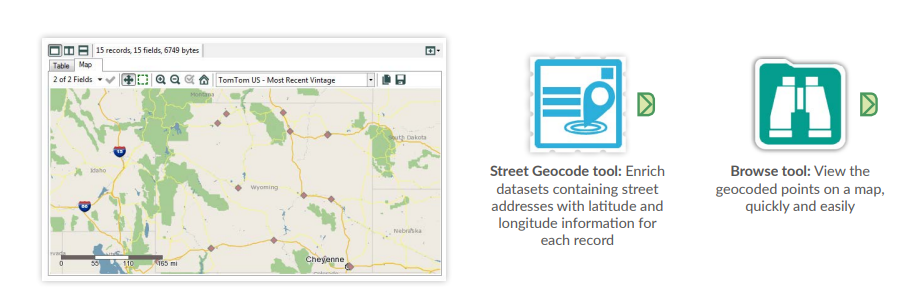
2. Turn Addresses into Locations:
The Street Geocode tool in Alteryx quickly transforms your standard addresses (like customer locations or branch sites) into geographic coordinates (latitude and longitude). This “spatializes” your data, adding a new data point for each location.
In this example, we’ll use it to geocode both customer and site data.
3. Define Your Trade Zone:
The Trade Area tool lets you see what’s happening within a specific area around each location. For example, you can create a 10-minute drive time polygon. This “draws” a zone around each location, encompassing all areas reachable within a 10-minute drive using the road network.

4. Blend Datasets Together:
The Spatial Match tool lets you see how different sets of locations relate to each other. For instance, you can use it to find out how many customers live within (or outside) the 10-minute drive time zone you created for each location. It essentially compares your customer data points (spatial points) with the trade area polygons (spatial objects) to identify matches based on spatial relationships (like “contains” or “intersects”).

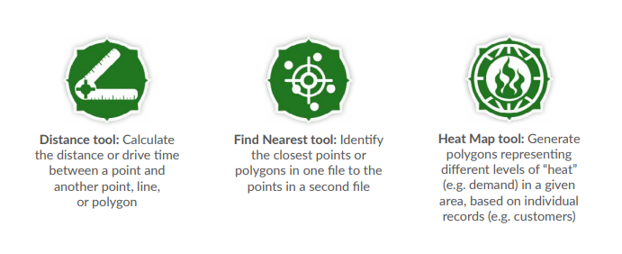
5. Use Advanced Spatial Analytics for Additional Insights
Alteryx offers a range of additional tools for advanced spatial analysis, making it accessible to users beyond data specialists. Additional tools include:
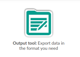
6. Visualise and Share Your Findings:
Alteryx doesn’t just help you crunch data – it enables you to share your insights clearly.
Visualize Your Success: Overlay data on detailed maps or satellite imagery using advanced mapping tools.
Spread the Knowledge: Export your analysis in various formats like Excel, ESRI, or even Tableau and Qlik for seamless integration with other data workflows and presentations.
Beinex + Alteryx Offerings
As a Premier Alteryx partner, we have extensive experience and a proven track record of success. Our team is highly skilled in Alteryx solutions and can help you unlock the full potential of this powerful platform.
Contact us today to learn more about how Alteryx and our partnership can take your business to the next level.
Image Source: https://community.alteryx.com/pvsmt99345/attachments/pvsmt99345/general-discussions/2303/2/Spatial_Cookbook_Victa.pdf